Maps
for the 1999 Florida Shrine Convention
Last update: February 04, 2005
- SunCoast Florida Color Map (72dpi)
(127K JPEG - Download time approximatley 45 sec. @ 28.8Kbps)
- Shows major roads and highways and points of interest.
 SunCoast
Florida Color Map (300dpi)
SunCoast
Florida Color Map (300dpi)
(266KB Adobe Acrobat .PDF File - Download time approximately 2 min. @ 28.8Kbps)
- Shows major roads and highways and points of interest. Has higher resolution and using
Adobe Acrobat you can zoom in for greater detail in on-screen viewing. This version is
also more appropriate for printing (especially in color).
To download a free PDF reader, click here
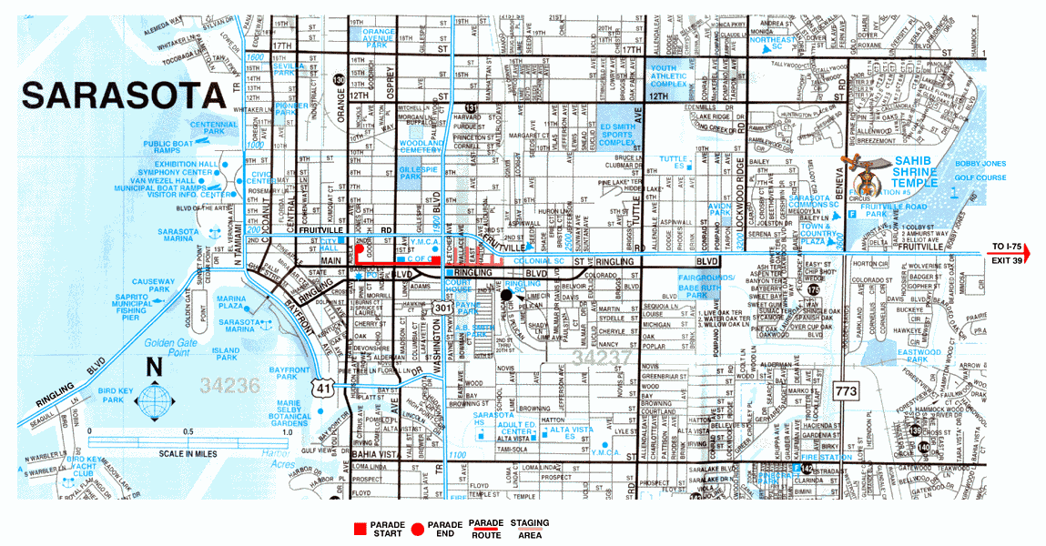
City of Sarasota Detailed Color Map (600 pixels x 1149
pixels - 72dpi)
(284K GIF - Download time approximatley 2 min. @ 28.8Kbps)
- Shows FSA Parade route and location in relationship to
Sahib Temple.
City of Sarasota Detailed Color Map (150dpi)
(292KB Adobe Acrobat .PDF File - Download time approximately 2 min. @ 28.8Kbps)
- Same as GIF above, shows FSA Parade route. Has higher
resolution and using Adobe Acrobat you can zoom in for greater detail in on-screen
viewing. This version is also more appropriate for printing (especially in color).
To download a free PDF reader, click here
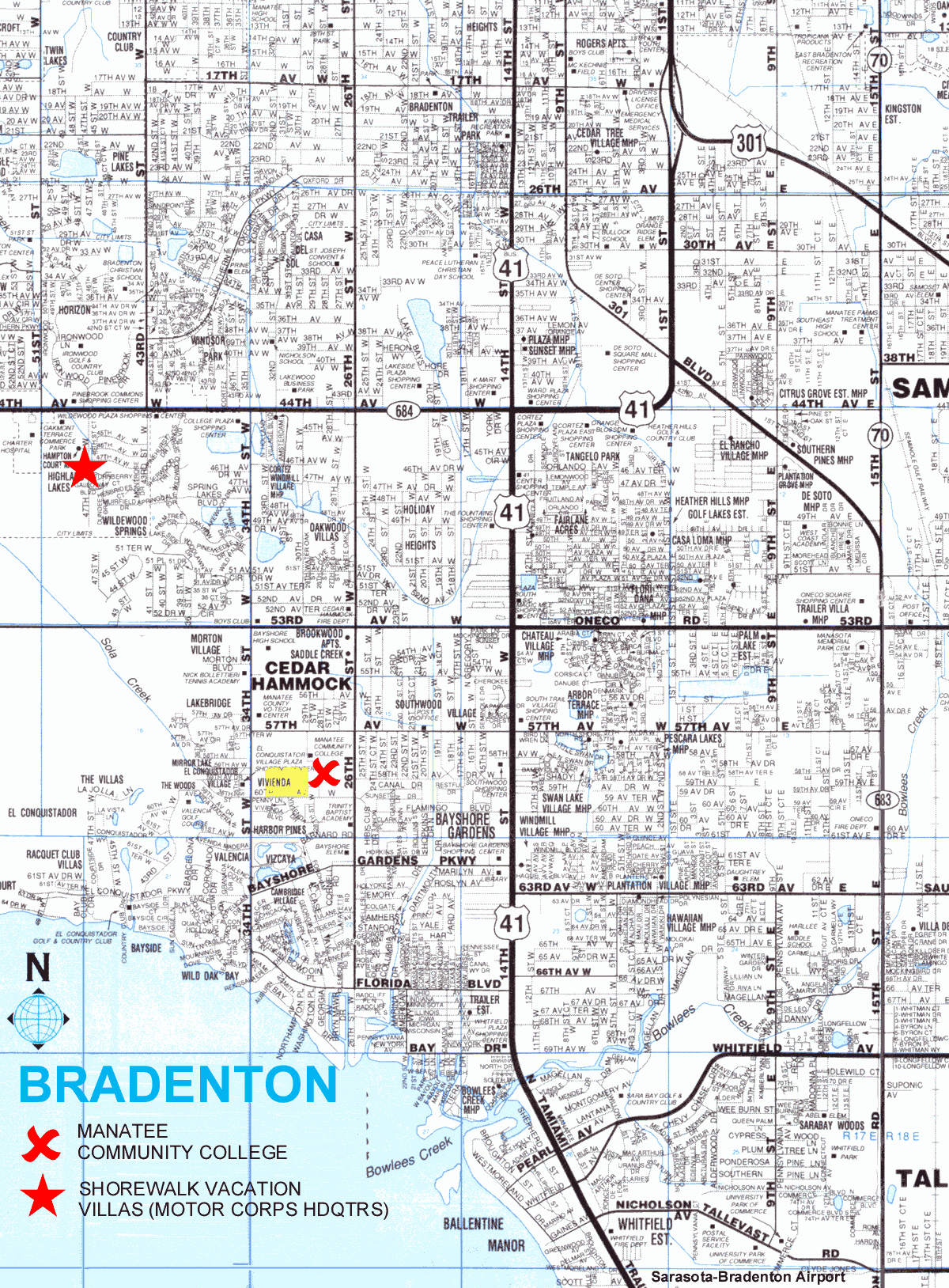
Bradenton/Manatee Community College Detailed Color Map
(1200 pixels x 1648 pixels - 72dpi)
(433K GIF - Download time approximatley 3 min. @ 28.8Kbps)
- Shows Motor Corps Competition Venue and Headquarters site.
Bradenton/Manatee Community College Detailed Color Map (150dpi)
(491KB Adobe Acrobat .PDF File - Download time approximately 4 min. @ 28.8Kbps)
- Same as GIF above, shows Motor Corps Competition Venue and
Headquarters site. Has higher resolution and using Adobe Acrobat you can zoom in
for greater detail in on-screen viewing. This version is also more appropriate for
printing (especially in color).
To download a free PDF reader, click here
FSA99 Market Place Map
This area is under construction.
Evenually, maps will show
location of official hotels/motels
and competition venues. |
 |
Return to FSA 99 Home Page